Larapinta Trail - Day 3 - Arenge View to Pravda Spur
6:54am - reaching “Arenge View”
Day 3 - a shorter day planned than day 2, but with my first big ascent! A total of 18.6km, but an ascent of around 350m up to my campsite at 1100 metres altitude.
I broke the day up in to sections - first, from my campsite to Mulga Camp where I would top up my water and have breakfast. Then from Mulga Camp to Jay Creek - the start of Section 3. From Jay Creek to Fish Hole, where would be my last chance of water. Then up to Pravda Spur on the high route along Section 3.
I left camp early again (around 6:30am), and this was the only time along the trail where I wore my fly net for a couple of hours!
It didn’t take long that morning for me to find a sign hiding in the grass, that said “Arenge View”. I’m glad I stopped hiking when I did on the previous afternoon - the designated “view” was not as good as the view I had stopped for, and the flat ground for a tent was non-existent!
The trail was quite overgrown, but by now I was understanding it’s ways and where it wanted me to walk. The trail markers were much less regular than I was used to on marked trails in the Top End. This was probably because the growth in Central Australia is typically much less, and the risk of the trail becoming overgrown is far lower. Generally speaking the trail is well worn and easy to follow. Due to the unusually high rainfall and the fact I was walking so early in the season, the trail was sometimes quite difficult to see. In those first 3 days, I kept losing the trail and I had to pull the GPS out a couple of times to get myself back on track.
Those first three days I also saw a LOT of HUGE orb weaver spider webs, straight across the path. My trekking pole doubled as a web destroyer and I really had to watch where I was walking unless I wanted to end up with a ginormous spider on my face. For the record, I did not want that. I did however, experience a lot of grasshoppers to the forehead.
A quick breather at the official “Arenge View”, before I continued on to Mulga Camp for breakfast and a toilet stop! There wasn’t too much of excitement for me to shoot on this first section of my day - the terrain was relatively flat and uninteresting and I just wanted to get the first 10km out of the way so I could get on to the more exciting terrain! My pack was feeling heaps more comfortable again, and I was generally in a much happier place!
I arrived at Jay Creek at lunch time, and decided to eat my evening meal here to conserve water later on. There was also my first USB charging point of the trail! So I recharged my phone and little Sony RX100 camera I was carrying.
Half way through Day 3 - from Jay Creek
Fish Hole
Creek crossing, just before my ascent up to Pravda Spur
Beginning the ascent in Section 3, climbing above Fish Hole
I do remember wishing I had more time at Fish Hole - this was the first decent water body I had come across on the trail really, and it was looking beautiful after a high rainfall season. This is probably one spot I wouldn’t mind revisiting - luckily it can be reached fairly easily (e.g. an overnight walk from Standley Chasm to Jay Creek return). I also found out later that this place has cultural significance with the Arrernte people, which made it feel even more special.
Looking back now, I don’t really remember the ascent of Pravda Spur - I don’t remember if I thought it was long or short, easy or difficult… and I thought I took a lot more shots going up the mountain than I actually did! However, there were a LOT of hills to be climbed on this 230km trail and I remember taking lots of ascent shots on Brinkley Bluff and other ascents… I remember more clearly what those ascents were like! I think for this first one I must have just been so focused on the walking and what I had to do, that I forgot to actually take the time to pay as much attention. I do find that it sometimes takes me a few days out bush to become more in tune with myself and the surroundings, so I’ll just count this ascent as a practice one and make sure I give more information on the coming days…. haha! Hopefully the photography tells just as much of the story!
The trail winding up the high route
This camp ended up being one of my top 3 camps on the whole trail. I loved it!
I loved these dramatic rock shapes at the high point on Section 3!
Afternoon light from Pravda Spur
Sunset from Pravda Spur - with the Sony RX100
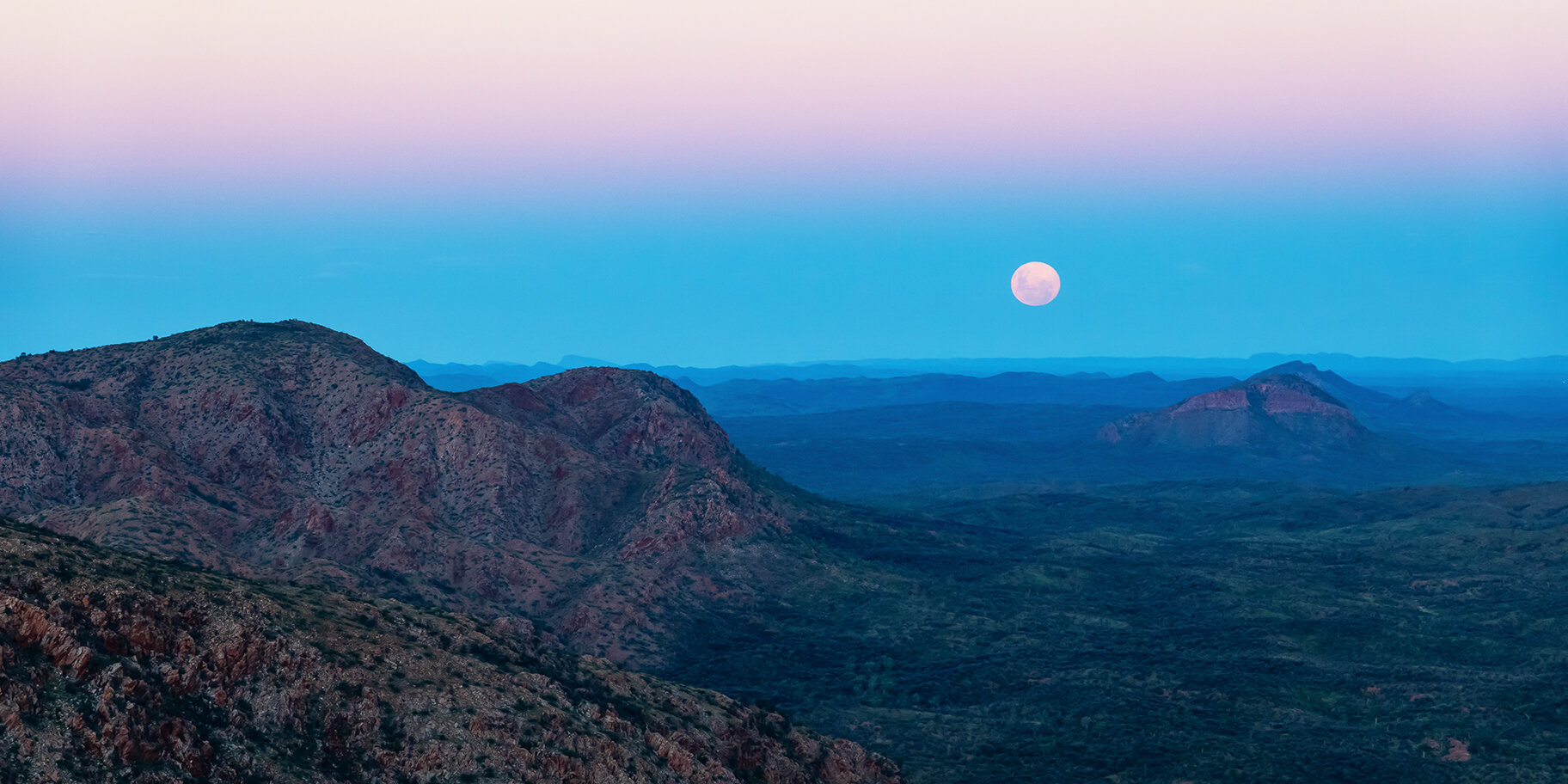
That after-dusk pink hazy glow, and the full moon rise
Moonrise from Pravda Spur, captured with the little Sony RX100 VI - great little camera!


